You are here: Home / Additional modules / Marketplace / Provider overview / Geolyzer - infrastructure data
Marketplace
Geolyzer – infrastructure data
Infrastructure data is in high demand. For this reason Bitlane has developed a tool on behalf of onOffice that you can use free of charge via the Marketplace.
The Geolyzer offers an advanced site plan creation / good extension to the site plan.
The service will be unlocked just like any other service in the Marketplace.
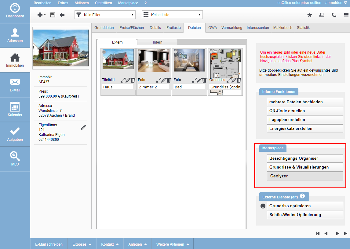
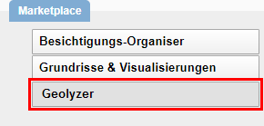
If Geolyzer is enabled in the Marketplace, you can find the service in the property in the Files tab. There you will find the new category “Marketplace” on the right.
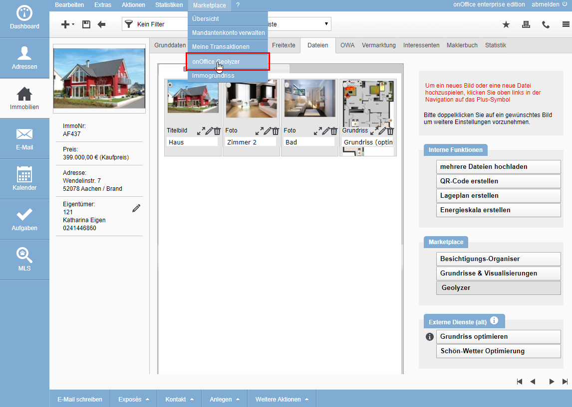
Alternatively, the service can be opened from within a property via the Marketplace menu.
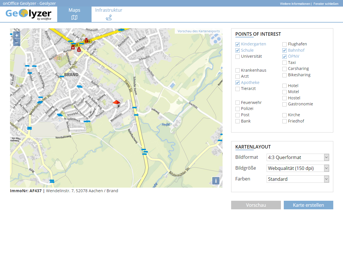
The popup with the Geolyzer opens. The contact of the property is automatically taken over:
- ImmoNo.
- Street, house number
- Zip code, city
Attention: For correct functioning, the entered contact of the property must be correct.
Maps
By default, the “Maps” tab opens first with a map view of the location.
You can zoom in the map and drag and drop the section to adjust it to your liking.
- Points of Interest; Decide by checkbox which information is displayed in the map by icon. The data for the points of interest come from OpenStreetMap.
- Map layout
- Image format: Choose from the standard formats. Free definition of the format is not possible.
- Image size: Determine the resolution, depending on how the site plan is to be output.
- Colors: The color scheme can be customized (standard, gray or CI).
“Create map” generates a site plan according to your specifications and stores it with the file type “Site plan” in the files.
Attention: Please refresh the view of the property so that the map is visible with the files.
Infrastructure
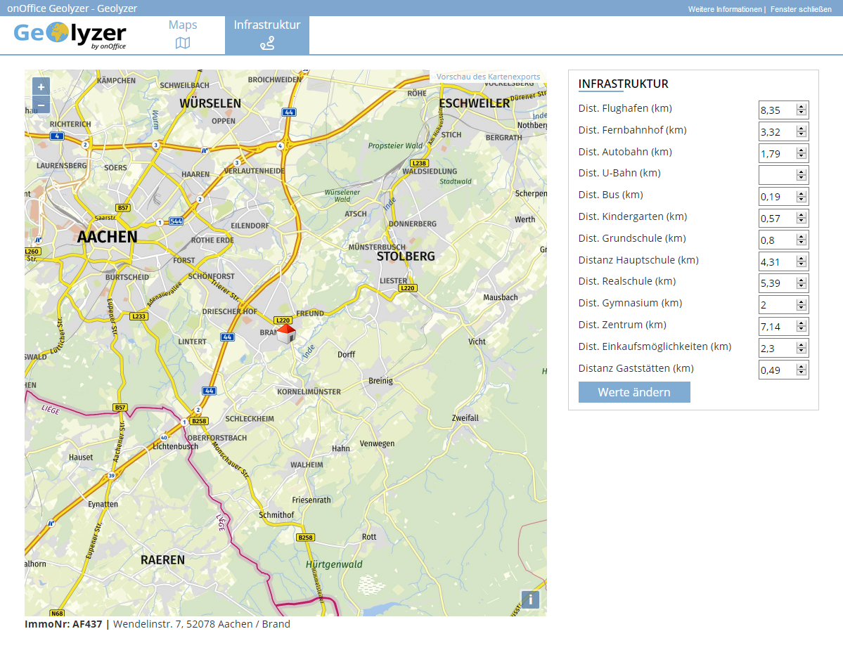
On this tab, the tool automatically calculates the distances to certain infrastructure points. The data comes from OpenStreetMap.
Via “Change values”, the details can be adjusted, supplemented and saved as required.
The distances are automatically saved in the property on the “Details” tab under “Infrastructure”.
- Value added tax on marketplace purchases
- Assign debits via reference ID
- Provider overview
- onOffice Services - PriceHubble Valuation Service
- onpreo - Property acquisition
- Wordliner - Acquisition marketing software
- Space Renovator- Virtual Homestaging
- onOffice Services - DocuSign Connector - digital signatures
- onOffice Services - Newsletter Connector
- onOffice Services - WKO Marketplace - Portal for joint business in Austria (MLS)
- onOffice Services - Zapier - Data exchange and automation
- PriceHubble Deutschland GmbH - Interactive property value analysis
- propform.io - Webforms
- PropNow - Digital quotation process
- PROPUP - Digital form & workflow management
- Residenture - Online auction platform
- onOffice Services - Gender API
- Sprengnetter property Valuation
- Sprengnetter - Real estate valuation in Europe
- timum - sightseeing organizer
- Total Render - Floor Plans Italy
- ViertelCheck - Information on the micro and macro situation
- finioo - Application folder
- Justhome - Real estate financing
- Backbone - Property images
- BOTTIMMO - Marketing software and digital acquisition
- bots4you - Universal messaging platform
- ESYSYNC - Display systems
- FPRE - property analysis and valuation
- Geolyzer - infrastructure data
- immo-billie - Digital bidding process
- Immogrundriss - Floor plans & visualizations
- immowriter - AI for property texts and images
- AreaButler - Interactive maps and AI assistant
- Kerberos compliance management systems
- KIM real estate valuation
- Lead Import
- Tenant check - credit check of prospective tenants
- MYVIVENDA - Print on Demand
- Ogulo - 360° tour
- onOffice Services - PhotoDesigner
- onOffice Services - AI-Writer - AI for property texts
- Service not usable?
- Use service
- Unlock/lock provider
- Manage account
- Create account

 Introduction
 Dashboard
 Addresses
 Properties
 Email
Email Calender
 Tasks
Tasks Acquisition Cockpit
 Audit-proof mail archiving
 Automatic brochure distribution
 Billing
 Groups
 Intranet
 Marketing box
 Multi Property module
 Multilingual Module
 onOffice sync
 Presentation PDFs
 Process manager
 Project management
 Property value analyses
 Request manager
 Showcase TV
 Smart site 2.0
 Statistic Tab
 Statistics toolbox
 Success cockpit
 Time recording
 Address from clipboard
 Boilerplates
 Customer communication
 External Tools
 Favorite links
 Formulas and calculating
 Mass update
 onOffice-MLS
 Portals
 Property import
 Quick Access
 Settings
 Templates
 Step by step